
La Laguna · Towns of Tenerife
San Cristóbal de La Laguna: a town planned for peace
Laid out on an empty plain at the end of the fifteenth century and never walled, La Laguna became a template for Spanish towns across the Atlantic. Its story, told from the documents.
8 min read · 10 sources · Updated October 2026
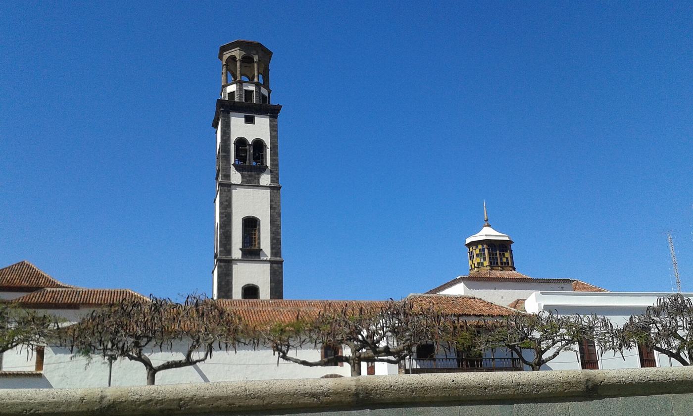
Iglesia de la Concepción · Axel Cotón Gutiérrez, CC BY-SA 4.0
Most old European towns grew slowly, street by street, behind walls. San Cristóbal de La Laguna did the opposite. It was laid out on an empty plain at the end of the fifteenth century, it never had walls, and within a few decades its straight streets and open squares had become a template that Spanish settlers would carry across the Atlantic. That is why, in 1999, UNESCO added its historic centre to the World Heritage List, as the first unfortified Spanish colonial town and a model for many towns in the Americas.1
Aguere, before the town
Before the conquest the plain was called Aguere. It lay between four Guanche kingdoms, the menceyatos of Tegueste, Anaga, Güímar and Tacoronte, and served them as shared seasonal pasture. The name is usually read as "lagoon", after the shallow lake that collected on the plain.2
The plain was also a battlefield. On 14 November 1495 the Castilian army of Alonso Fernández de Lugo defeated the northern Guanche forces led by Bencomo, mencey of Taoro, in the battle of Aguere, a turning point in the conquest of the island.3 The last menceyes surrendered in 1496. Tradition places the end of the war close to 25 July, the feast of Saint Christopher, who gave the new settlement its name.2
Two foundations
La Laguna was founded twice, and historians still give slightly different years for each step.
In the summer of 1496 the conquerors celebrated Corpus Christi in a newly built church dedicated to the Immaculate Conception, an event later treated as the town's first foundation.2 The settlers, most of them soldiers, were not given building plots. They put up small houses of rough stone with straw roofs around the church, without any overall plan. That first nucleus, the Upper Town or Villa de Arriba, still shows its irregular streets today.14 The island's governing council, the Cabildo, held its first meeting on 20 October 1497.2 Some authors therefore date the foundation to 1496 and others to 1497.15
The second foundation was deliberate. On 24 April 1500 Lugo, now Adelantado (governor) of the island, banned the building or sale of new houses in the old town and ordered new construction to move towards "el logar de Abaxo", the lower ground to the south-east.2 There, around the church of Los Remedios and a square in front of the Adelantado's own houses, a regular grid of straight streets was laid out: the Lower Town or Villa de Abajo. The dates given for this plan range from 1500 to 1502.12
Where did the idea of the grid come from? The nomination file sent to UNESCO in 1998 presented La Laguna as an "ideal city" inspired by navigation charts and even by Leonardo da Vinci's plan of Imola.1 More recent research is cautious. The astronomers Alejandro Gangui and Juan Antonio Belmonte call such proposals "somewhat far-fetched" and point to simpler precedents: grid towns already founded in lower Andalusia, such as Puerto Real and Santa Fe de Granada. What was new in La Laguna was not the grid itself but its use for an open, unwalled town in newly conquered land.2
A town without walls
Earlier Canarian settlements had been fortified. La Laguna could do without walls because it was built inland, on high ground that controls the routes between the north and south of the island, out of easy reach of pirates, on an island that was by then fully conquered.12
Its main street, Calle de la Carrera, links the first parish church with Plaza del Adelantado, and the parallel Calle San Agustín, lined with the houses of early merchants, forms the geometric centre of the town.1 Gangui and Belmonte measured the orientation of twenty-one historic churches in the old centre. Most face a solar direction that could correspond to sunrise or sunset around the feast of Saint Christopher in late July, while the equinoctial or solstitial alignments proposed by some earlier writers are not dominant. They suggest that the cathedral of Los Remedios, between the two halves of the town, may have set the pattern for the others.2
People of the new town
The town grew quickly. In 1514, 316 households were counted so that each could be assigned its share of cleaning the lagoon. By 1552 a street-by-street survey of grain stores listed 5,386 people in 840 households.6 UNESCO's evaluation describes La Laguna by the 1550s as the largest town in the Canary Islands.1
The council built infrastructure early: piped water in 1521, the first public buildings in 1525. The town asked for the status of a city from 1514 and obtained it in 1531, and in 1554 the council ordered the demolition of straw-roofed buildings to reduce the risk of fire.1
Not everyone in the town was free. The parish registers of Los Remedios and La Concepción record the baptism of 802 adult slaves between 1543 and 1599. Slightly more than half were women, and in the few entries that give an age almost all were children or teenagers. The historian Alberto Marcos Martín, who studied these registers, describes slavery in La Laguna as largely domestic, a reminder of the human cost behind the prosperity of the sixteenth-century Canaries.6
Churches, convents and houses
Many of the town's landmarks can be dated precisely from the documents:
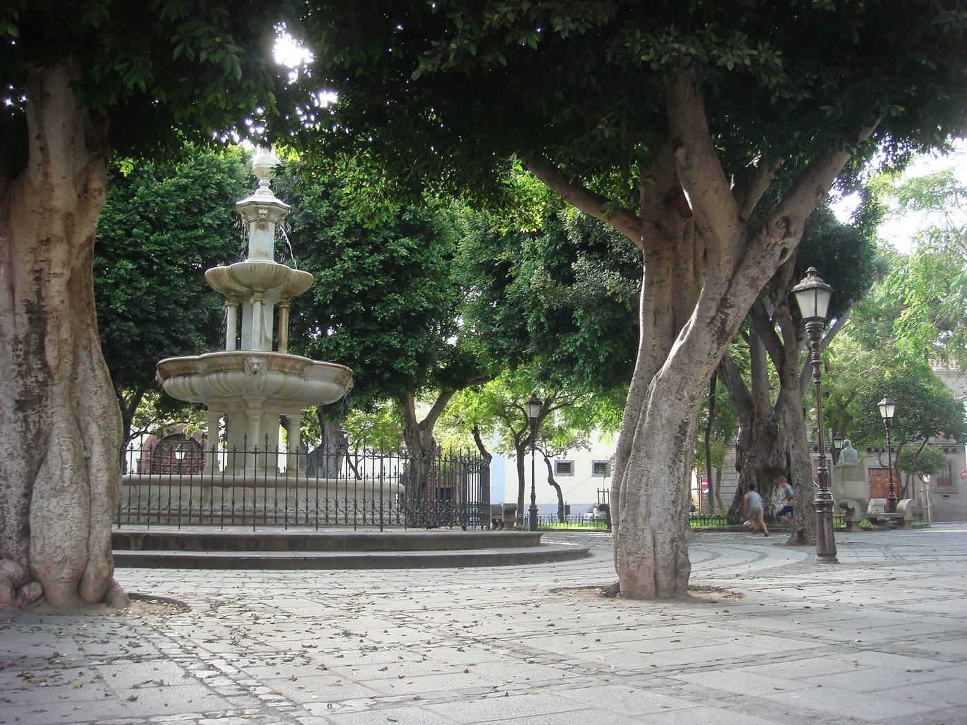
- Ermita de San Miguel, on Plaza del Adelantado. Lugo ordered it in his will, signed on La Gomera on 5 March 1504, "facing my houses". It was founded in May 1506 and rebuilt and enlarged in the eighteenth century; the date 1759 is carved on the keystone of its façade.5
- La Concepción, the mother church of the island, was rebuilt from 1511 and altered many times since, which explains its mixture of styles.1
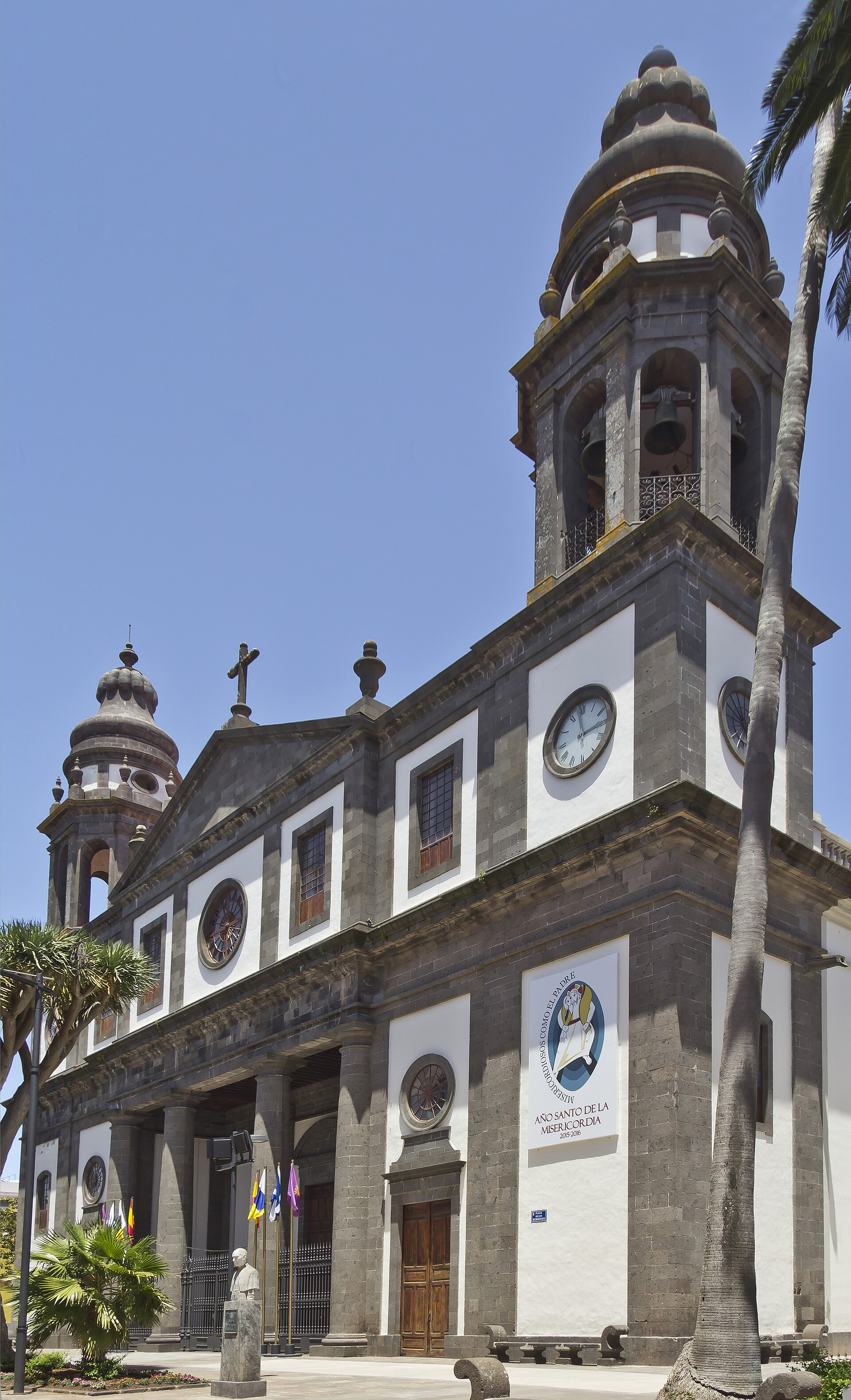
- Los Remedios, begun in 1515, became the cathedral when Pope Pius VII created the Diocese of Tenerife in 1819.17
- Santo Domingo was begun in 1522; part of its crenellated garden wall, now beside the University of La Laguna's rectorate, already appears on Torriani's plan.5
- The convent of San Miguel de las Victorias, better known as San Francisco or El Cristo, housed the town's most venerated image, the Christ of La Laguna, said by tradition to have been brought by Lugo around 1520. The confraternity devoted to it, the Esclavitud, was founded in 1659. On the night of 28 July 1810 the church burned down; only the image and the silver were saved.58
- Santa Catalina de Siena, the Dominican convent on Plaza del Adelantado, stands where Lugo's own houses were. After his death in May 1525 and his son's departure for Santa Marta (in present-day Colombia) in 1535, the houses fell into ruin; a sale deed of 1600 describes them as collapsed except for one front room. The convent opened on 23 April 1611 with four nuns from Seville.5
- Among the town houses, the Casa del Corregidor (1545), the Mannerist Casa Lercaro (late sixteenth century, now the History Museum of Tenerife), the Casa de Alvarado Bracamonte or House of the Captains General (1624-1631) and the Casa de Salazar (1682), now the bishop's palace, trace the town's wealth over two centuries.1
The lagoon that gave the town its name
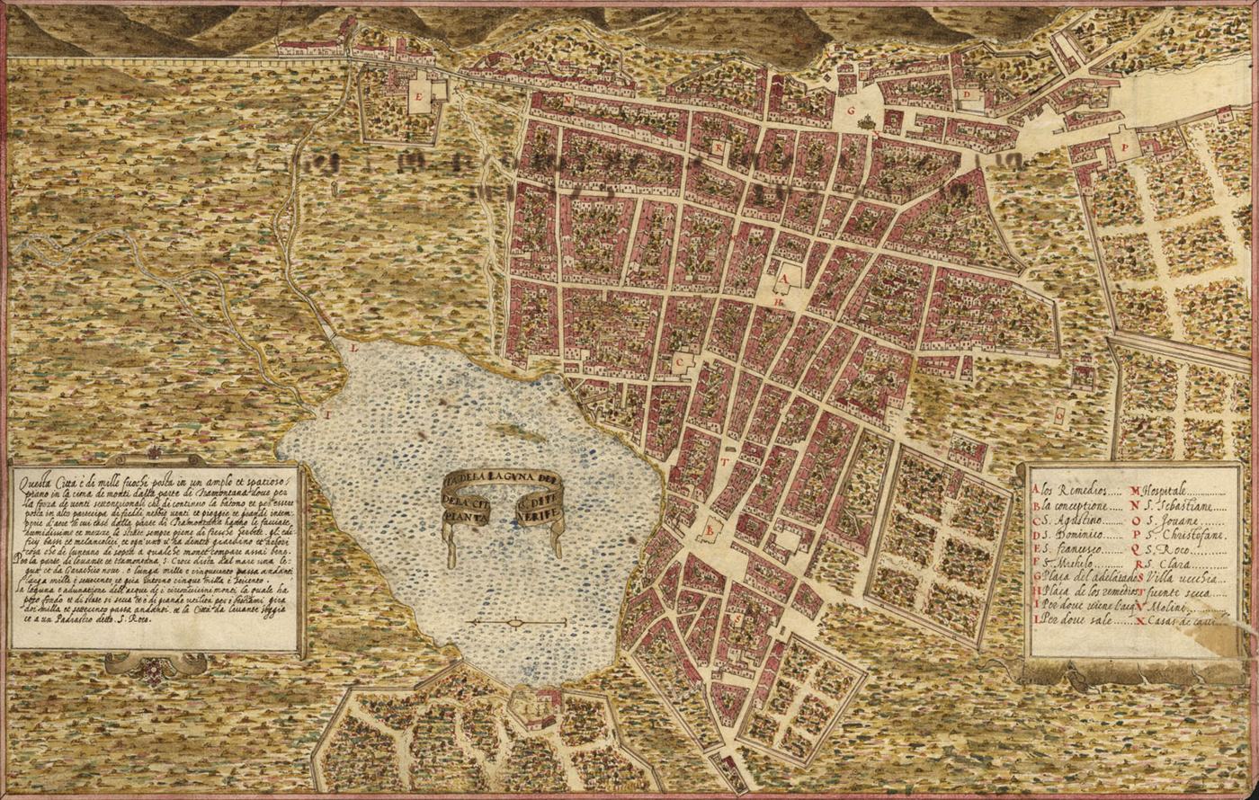
The lake that gave La Laguna its name appears on Torriani's plan. The geographer Constantino Criado has reconstructed it as a seasonal wetland of about three hectares, less than a metre deep. Deforestation, grazing and farming filled it with sediment from the sixteenth century on, and it served as a watering place for livestock and as a place to wash clothes. It had effectively disappeared by the 1770s; a drainage channel dug in 1837 finished the job.19
Losing the capital, keeping the culture
During the eighteenth century political and economic power moved to the port of Santa Cruz. A brief revival came in 1808, when the Supreme Council of the Canary Islands sat in La Laguna, but it was dissolved a few years later.1 What the town kept was learning and the Church. University teaching in La Laguna goes back to 1701; Charles IV decreed a university on 11 March 1792, and it opened in 1817, only to be closed in 1845. The modern University of La Laguna was created on 21 September 1927 and has worked without interruption since.10
UNESCO's evaluation makes a striking point: two centuries of relative economic decline were what saved the old town. With little money for rebuilding, the streets, squares and façades survived, and some craft quarters still house the trades that settled there in the town's first years.1 Today the historic centre, protected since 1985 and a World Heritage Site since 1999, is a living town of students, shops and processions laid out on the plan of five centuries ago.1 The municipality also reaches the sea, at Bajamar and Punta del Hidalgo, whose story is told in its own article.
Notes and sources
- 1.ICOMOS, Advisory Body Evaluation: San Cristóbal de la Laguna (Spain), No 929, UNESCO World Heritage Centre, September 1999. whc.unesco.org
- 2.A. Gangui and J. A. Belmonte, "Urban Planning in the First Unfortified Spanish Colonial Town: The orientation of the historic churches of San Cristóbal de La Laguna", Journal of Skyscape Archaeology (2020), citing E. Aznar Vallejo (2008) and A. Alemán de Armas (1986). arXiv:2003.12410
- 3.The date commonly given in the literature on the conquest, whose standard work is A. Rumeu de Armas, La conquista de Tenerife 1494-1496 (1975). Gangui and Belmonte (note 2) write November 1494, which conflicts with all other sources.
- 4.A. Marcos Martín, "La esclavitud en la ciudad de La Laguna durante la segunda mitad del siglo XVI a través de los registros parroquiales", Investigaciones Históricas 2 (1980), citing A. Rumeu de Armas and A. Cioranescu.
- 5.A. Tejera Gaspar and L. Martínez Díaz, "San Cristóbal de La Laguna: un estudio desde la Arqueología de la Arquitectura", Anuario de Estudios Atlánticos 66 (2020), pp. 1-19. redalyc.org
- 6.A. Marcos Martín (1980), as note 4. uvadoc.uva.es
- 7.J. J. Suárez Acosta and L. González Duque, "La supresión de la diócesis de Tenerife en los expedientes civiles del Ayuntamiento de San Cristóbal de La Laguna", Almogaren 5 (1990).
- 8.C. Marrero Brito, "El antiguo templo del convento de San Miguel de las Victorias de La Laguna", De Arte 18 (2019), pp. 123-134.
- 9.C. Criado Hernández, Breve e incompleta historia del antiguo lago de la ciudad de San Cristóbal de La Laguna (2002), as reviewed by J. I. Bolaños González, Cuadernos Geográficos 34 (2004).
- 10.Universidad de La Laguna, "Historia, misión, visión y valores" (official history). ull.es