
Weather
Tenerife's weather, floor by floor
Under ten kilometres separate Santa Cruz from Los Rodeos, yet the airport is almost five degrees cooler and gets more than twice the rain. Above them, Izaña has frost on more than fifty days a year and more sunshine than the coast. How the trade winds, an invisible lid of warm air and the relief turn one island into a stack of climates, what happens when that machine breaks down, and why the summits are warming three times faster than the coast.
13 min read · 20 sources · Updated October 2026
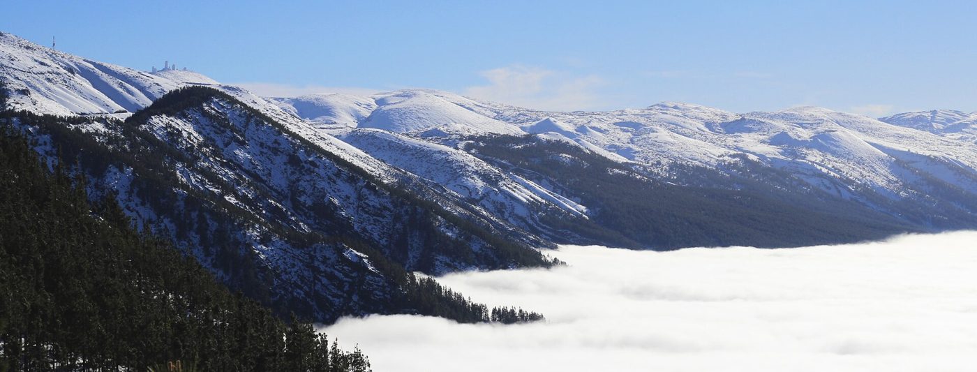
Snow above the sea of clouds, February 2016 · Alejandro Hg, CC BY 3.0
In short
- Four official AEMET stations, four climates: an annual mean of 21.5 °C in Santa Cruz, 16.8 °C at Tenerife Norte airport 600 m higher, about 10 °C at Izaña, and 132 mm of rain a year at Tenerife Sur against 520 mm at Tenerife Norte.1,2,3,4
- The machine behind it is the trade wind trapped under a temperature inversion: a cool, moist layer below roughly 1,200 to 1,600 m, a warm, very dry one above. The sea of clouds is the visible top of that lid.5
- The north-facing slopes take the moisture; the air that crosses the island comes down the other side drier and warmer.5
- The extremes arrive when the machine breaks: Saharan air turns the gradient upside down and makes the hills hotter than the beach, and cut-off lows (DANAs) bring rain from directions the island is not built for.
- Climate change is not uniform either: since 1950 night-time temperatures at the summits have risen about three times faster than on the coast.6
Four stations, four climates
The cleanest way to see Tenerife's microclimates is to put the official climate normals of the State Meteorological Agency (AEMET) side by side. These are 30-year averages (1981-2010) from four stations a few kilometres apart:1,2,3,4
- Santa Cruz de Tenerife, 36 m. Annual mean 21.5 °C. The coldest month averages 18.2 °C, the warmest 25.5 °C. 226 mm of rain on about 30 days a year, 2,913 hours of sunshine.
- Tenerife Norte airport (Los Rodeos, La Laguna), 632 m. Annual mean 16.8 °C: 4.7 degrees colder than the capital, less than ten kilometres away. 520 mm of rain on 64 days, more than twice as much and twice as often. In December it rains 82 mm; in July, 6.
- Tenerife Sur airport, 64 m. Annual mean 21.4 °C, practically the same as Santa Cruz, but only 132 mm of rain on 15 days a year. In June and July the average rainfall is zero.
- Izaña, 2,369 m. January averages 4.3 °C with nightly minimums of 1.1 °C; July averages 18.5 °C. About 54 days of frost and 10 days of snow a year, 84 days of fog, and the most sunshine of the four: the monthly averages add up to about 3,470 hours, with 382 hours in each of June and July.
Two things stand out. First, altitude, not latitude, sets the temperature: from Santa Cruz to Izaña the mean drops about 11 degrees over 2,333 m, roughly 0.5 °C per 100 m (our calculation from the AEMET normals). That is less than the 0.65 °C of a textbook atmosphere, because the summit sits in a layer of warm, sinking air, as explained below. Second, the summit has twice the seasonal swing of the coast: 14 degrees between its coldest and warmest month against 7 in Santa Cruz, where the ocean acts as a buffer.
A study of 53 AEMET stations across the archipelago from 1950 to 2023, by geographers at the University of La Laguna, puts the general rule in numbers: below 300 m the average monthly minimum is 18 °C, above 1,200 m it is 8 °C, and altitude alone explains 87 % of the variation in minimum temperatures between stations.6
The lid: trade winds and the inversion
For most of the year the Canaries sit on the eastern flank of the Azores high. The air sinking out of that anticyclone warms as it is compressed, and it meets the cool, moist air that the trade winds carry over the Canary Current, a cold current. Where the two meet there is a temperature inversion: instead of getting colder with height, the air suddenly gets warmer and drier.5
That inversion is a lid. Below it, the trade wind blows from the north-east up to about 700 m; between roughly 700 and 1,500 m winds are weak and turn south-westerly; above 1,500 m they blow from the west or north-west. Above 2,000 m the air is usually very dry, with relative humidity below 25 %.5 Everything that makes the north of Tenerife green happens under the lid.
The sea of clouds, measured
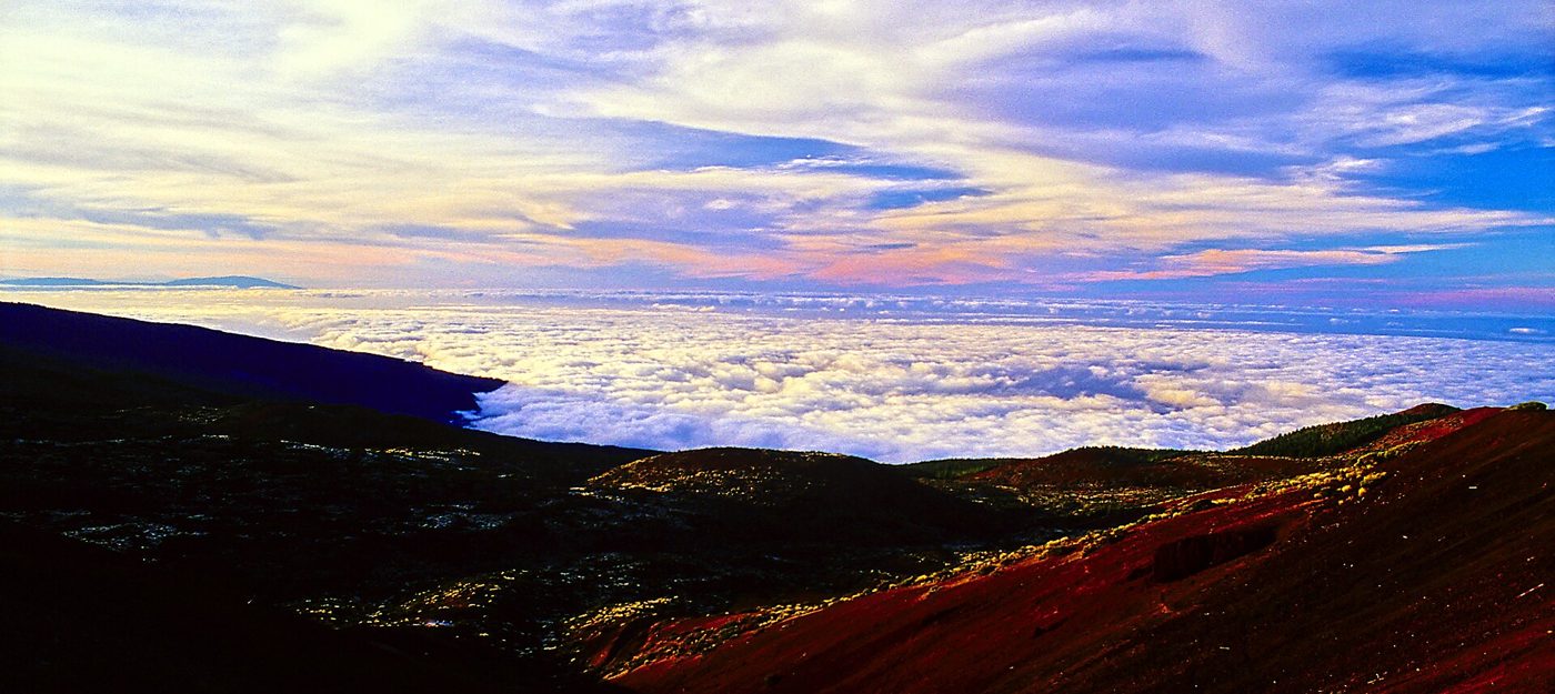
When the moist layer is pushed up against the island, it condenses into a sheet of stratocumulus: the mar de nubes. Its height and frequency were measured from Izaña between 1939 and 1950 by the meteorologist Inocencio Font Tullot. Its top averaged 1,570 m in January and 1,240 m in July. In July it was there in 90 % of observations; in January in 29 %.5
So the cloud is more frequent in summer but thinner: from October to March the cloud layer is more than 1,500 m deep on half of the days, while in July and August it is usually under 1,000 m, because in winter cold, moist polar air often reaches the islands and deepens it.5
The consequence for anyone living under it is measurable. A radiometer at La Perdoma, in the Orotava valley at 550 m, recorded overcast skies on more than 40 % of days in every month between 2004 and 2019, 64 % in May, and never more than 17.5 % of fully sunny days in any month. At El Gaitero, at 1,745 m above the same valley, July had 88.7 % sunny days and summer overcast days were under 4 %.5 Same slope, same day, two different weather reports.
Windward, leeward and the water that comes out of fog
Air pushed up the northern slopes cools, loses much of its moisture as cloud and drizzle, and comes down the southern side warmer and drier, a foehn effect.5 That is a large part of why Tenerife Sur airport gets a quarter of the rain of Tenerife Norte, and why on some days the cloud spills over the rim of Las Cañadas near Guajara and dissolves as it falls, a "cloud waterfall" that evaporates into dry air.5
Where the cloud touches the forest, trees comb water out of it. Fog drip between about 900 and 1,600 m is hydrologically important.5 But its size is often exaggerated: a model of the Garajonay laurel forest on neighbouring La Gomera estimated about 110 mm a year, some 18 % of the water reaching the ground, and the authors called for more measurement.7 It is a real extra source of water for the forest belt, not a substitute for rain.
Above the clouds: Izaña
The Izaña observatory, with temperature records going back to 1916, usually looks down on the sea of clouds: it sits above the inversion most of the time.8,5
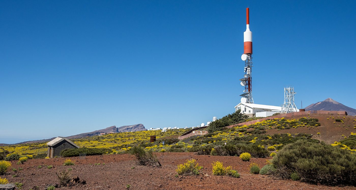
Above the lid the air is dry and clear, so the days are sunny and the nights lose heat fast: in January daytime highs average 7.5 °C and night-time lows 1.1 °C.4 Snow is a real if short-lived event, about ten days a year. At the same time it rains more at Izaña (392 mm) than in Santa Cruz, almost all of it between October and March, when Atlantic storms rather than the trade wind set the weather; in June and July it averages nothing.1,4
Heat that climbs the hills
Tenerife's heat waves do not behave like those on the mainland. When hot air from the Sahara moves out over the Atlantic, it rides above the cool marine layer instead of mixing with it.5 The inversion sinks, the coast often stays under a breeze or a thin cloud, and the hills take the full heat. In those episodes the usual gradient flips: the higher you go, the hotter it gets, up to a point.
- 9 August 2025: about 37 °C in the upper part of Los Realejos against 22 to 28 °C on the coast of Puerto de la Cruz and La Orotava. AEMET attributed the contrast to the inversion linked to the trade winds.9
- 4 November 2025: Tenerife Norte airport reached 33 °C, its November record, "widely" beating the 31 °C of 1998, and Llano de los Loros, in the hills of La Laguna, recorded 35 °C, the highest temperature in Spain that day.10
- March 2023: 38.9 °C at Las Galletas, a record for March.11 3 October 2023: 39.4 °C at Tenerife Sur airport.12
The same air brings calima, Saharan dust. The episode of 22-24 February 2020 closed every airport in the Canaries, with gusts of up to 120 km/h and about 800 flights cancelled or diverted.13 Hot, dry Saharan air with wind is also fire weather: the wildfire that started on the night of 15 August 2023 in the highlands of Arafo burned close to 15,000 ha in twelve municipalities and forced mass evacuations, more than 12,000 people on the night of 20 August alone. It is thought to have been started deliberately; heat, wind and very low humidity did the rest.14
DANAs: when the rain comes from the wrong side
A DANA (depresión aislada en niveles altos, a cut-off low) is a pool of cold air high in the atmosphere that has broken away from the general westerly circulation. The one that approached the islands on 9-10 October 2026 had temperatures of minus 14 to minus 16 °C at about 5,500 m.15 Cold air aloft over a warm autumn ocean makes the atmosphere unstable and allows tall storm clouds to grow, something the trade-wind inversion normally prevents.
A DANA also breaks the usual wind pattern, so heavy rain can fall on slopes and towns that the trade wind leaves dry, like the capital. The worst case on record in Tenerife is 31 March 2002: a convective system some 10 km tall stalled over Santa Cruz and dropped 232.6 litres per square metre in under six hours, with a peak of about 163 mm in an hour around 17:00. That is more than the city's average rainfall for a whole year (226 mm) in one afternoon. Eight people died and 647 homes and 423 commercial premises were affected.16,1
Storms and fog
On 28-29 November 2005 the remains of tropical storm Delta crossed the Canaries as a powerful extratropical storm. The Izaña observatory measured sustained winds of 98 knots and a gust of 134 knots, about 248 km/h; at Los Rodeos the strongest gust was 147 km/h.17 Seven people died across the islands and more than 300,000 were left without electricity.18 The same storm was felt very differently depending on altitude and exposure.
The trade-wind lid has a deadly history too. Los Rodeos lies at 633 m, right where the base of the cloud often meets the ground; AEMET's guidance for pilots notes that its impact on the airport is greatest when the inversion sits around the airfield's height.19 On 27 March 1977, two Boeing 747s collided on its runway in dense fog, with visibility falling from about 500 m to less than 100 m: 583 people died, the deadliest accident in aviation history.20 In 1978 the island's second airport, Tenerife Sur, opened at 64 m, in the zone that averages 15 rainy days a year.20,3
A climate that is not warming evenly
The Izaña series, which goes back to 1916, already showed its warmest years in 2010 and 2017 (11.6 °C), with the clearest increase in spring and early summer.8 The 53-station study by the University of La Laguna goes further: every station shows a statistically significant warming of minimum temperatures between 1950 and 2023, mostly since the 1980s, but the pace depends on altitude. Summit and high-midland stations such as Izaña and Vilaflor warmed by more than 0.2 °C per decade, and some high areas by about 0.3 °C; coastal stations such as Puerto de la Cruz and Taganana by slightly less than 0.1 °C.6
The explanation the authors give is the same inversion: above it, the summits are cut off from the moderating influence of the ocean.6 The coolest parts of the island, the forests and high pastures, are changing fastest.
Tenerife's microclimates, in numbers
Common myths
Myth
Tenerife has the same mild weather all year, everywhere.
Myth
The higher you go, the cooler it gets.
Fact
Usually, but not in Saharan air: on 4 November 2025 Llano de los Loros, in the hills of La Laguna, was the hottest place in Spain at 35 °C.10
Myth
If it is cloudy in the north, it is cloudy on the whole island.
Fact
In summer the cloud is usually a thin layer topping out around 1,240 m; at 1,745 m July is sunny on almost nine days out of ten.5
Myth
Warming hits the beaches hardest.
Fact
Night-time temperatures are rising about three times faster at the summits than on the coast.6
What to do
- Check the forecast for the altitude you are going to, not for your town: Puerto de la Cruz and La Esperanza can have different weather on the same morning.
- On a grey summer day in the north, the sun is usually only a drive away: above about 1,300 to 1,600 m you are normally over the cloud.
- Going up to Las Cañadas, count on roughly half a degree less for every 100 m and much colder nights; in winter the access roads close after snowfall.
- In a Saharan heat episode, the midlands can be hotter than the beach: walk early, carry water, and remember that this is also peak wildfire weather.
- With calima, keep windows closed and cut outdoor exercise, especially with asthma or heart disease.
- In heavy rain, never cross a flooded ravine (barranco) or park in its bed: on 31 March 2002 more than 160 mm fell in a single hour.
- Keep ES-Alert emergency notifications enabled on your phone.
Notes and sources
- 1.AEMET, standard climate values 1981-2010, Santa Cruz de Tenerife (station C449C, 36 m). aemet.es
- 2.AEMET, standard climate values 1981-2010, Tenerife Norte airport (C447A, 632 m). aemet.es
- 3.AEMET, standard climate values 1981-2010, Tenerife Sur airport (C429I, 64 m). aemet.es
- 4.AEMET, standard climate values 1981-2010, Izaña (C430E, 2,369 m), including days of snow, frost and fog. Annual sunshine is the sum of the monthly averages. aemet.es
- 5.Santana Pérez, L. M., Un sombrero sobre medianías y bosques: el mar de nubes en Tenerife, December 2020 (with Font Tullot's 1939-1950 Izaña observations and radiometric series 2004-2019). divulgameteo.es
- 6.Correa González, J., Dorta Antequera, P., López Díez, A., Díaz Pacheco, J. and Martín Raya, N., "Caracterización y evolución de las temperaturas mínimas en Canarias (1950-2023)", XIII International Congress of the Spanish Climatology Association (AEC). repositorio.aemet.es
- 7.University of La Laguna, model of fog water input in the laurel forest of Garajonay (La Gomera), 2009. portalciencia.ull.es
- 8.AEMET blog, "Análisis del comportamiento de la temperatura media anual en 2017 y de las series mensuales históricas 1916-2017 del Observatorio de Izaña", 23 January 2018. aemetblog.es
- 9.Diario de Avisos, "Contraste térmico en Tenerife: hasta 14 grados de diferencia en un mismo día", 9 August 2025. diariodeavisos.elespanol.com
- 10.RTVC, "Récord de temperatura en Tenerife Norte en noviembre: 33 grados", 5 November 2025. rtvc.es
- 11.RTVC, "Temperaturas récord para un mes de marzo, hasta los 38,9º C en Las Galletas, Tenerife", 31 March 2023. rtvc.es
- 12.Diario de Avisos (EFE), "Canarias es un horno: la Aemet registra la segunda temperatura más alta del país, 40,5 grados, en las Islas", 4 October 2023. diariodeavisos.elespanol.com
- 13.Hosteltur, "La calima que tapó el cielo de Canarias, vista desde el espacio", 27 February 2020. hosteltur.com
- 14.Wikipedia (en), "2023 Tenerife wildfire", consulted October 2026. en.wikipedia.org
- 15.Diario de Avisos, "Una DANA se acerca a Canarias: lluvias fuertes, tormentas y temperaturas por debajo de los 5 grados", 9 October 2026. diariodeavisos.elespanol.com
- 16.Wikipedia (en), "Tenerife flood of 2002", consulted October 2026; see also Royal Decree-law 2/2002 on aid for the damage (BOE, 6 April 2002). en.wikipedia.org
- 17.US National Hurricane Center, Tropical Cyclone Report, Tropical Storm Delta (AL292005). nhc.noaa.gov
- 18.RTVC, "Se cumplen 20 años del paso de la tormenta tropical Delta por Canarias", 28 November 2025. rtvc.es
- 19.AEMET, Guías de AEMET para el aviador, no. 102 (safety). repositorio.aemet.es
- 20.Wikipedia (en), "Tenerife airport disaster", consulted October 2026. en.wikipedia.org
Keep reading
Water
Tenerife drinks from inside the volcano
Sewage
What goes into the sea
Housing
Housing in numbers
Politics
Who governs the Canaries, and what comes next
Teide
How to legally stand on top of Teide
Volcano
The volcano under watch
Traffic
TF-5: anatomy of a traffic jam

Shopping
Why a parcel from Madrid can cost more than one from China
Population
Who lives on Tenerife
Hotels
Who owns Tenerife's hotels
Economy
What Tenerife lives on

Food and restaurants
Tenerife at the table